


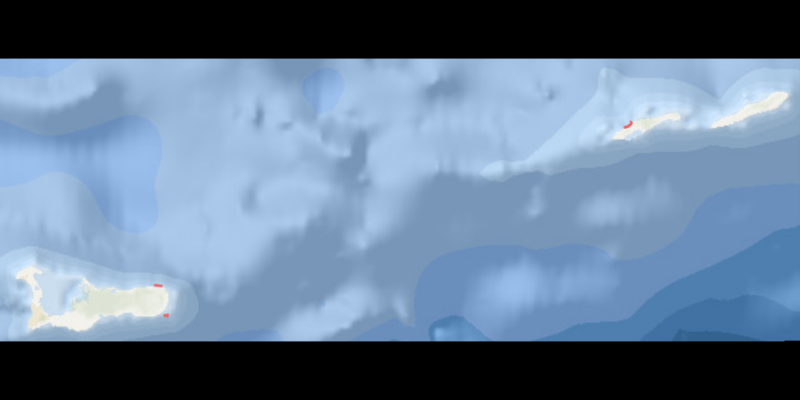
Three coastal areas in the Cayman Islands have been recognised as important habitats for sharks and rays. As the Cayman Islands Department of Environment announced on 20 October, Queen’s Highway and Gun Bay off Grand Cayman, together with Bloody Bay off Little Cayman, have been added to the regional ISRA atlas. The designation is based on regularly observed aggregations of the Endangered Caribbean reef shark.
Recognition through the IUCN SSC Shark Specialist Group’s ISRA project relies heavily on recreational divers’ observations. More than 57,000 recorded dives from 2017 to 2025 provided the data. This shows how observations collected over many years can contribute to the assessment of shark habitats.
Three small areas with recurring shark aggregations
The official factsheets describe clearly delineated areas extending to a depth of 30 metres. Recognition therefore does not apply indiscriminately to the entire coastlines of the two islands.
Queen’s Highway lies off the northeast coast of Grand Cayman and covers 0.41 square kilometres. Reef sharks were seen on 37.4 per cent of the 3,027 dives logged there. Sightings occurred throughout the year, with up to five animals seen together on individual dives. The area’s factsheet identifies coral reefs, coral rock and sandy substrates as its characteristic habitats.
Gun Bay, off Grand Cayman’s southeast coast, is slightly smaller at 0.38 square kilometres. Caribbean reef sharks were recorded on 42.3 per cent of 4,354 logged dives. The largest groups observed contained up to 15 animals. According to the Gun Bay factsheet, sightings peaked in July and August. Signs of mating and possible pregnancy also raise questions about the area’s role in reproduction.
Bloody Bay, on Little Cayman’s north coast, covers 0.79 square kilometres and overlaps the existing Bloody Bay Marine Park. Reef sharks were seen on 14.3 per cent of 4,951 logged dives, in groups of up to six animals. The Bloody Bay factsheet also records very young sharks: an individual classified as a neonate in January 2020 and a young-of-the-year shark in June 2025.
What the observations show — and what remains uncertain
The percentages refer to logged dives with sightings. They are not counts of distinct sharks and cannot be read as shares of an overall population. Repeated appearances in a small area make it interesting to researchers, but do not yet fully explain why the animals gather there.
All three areas were recognised under criteria for threatened species and aggregations whose function remains unclear. The factsheets call for further research into the purpose of these gatherings. Sightings of young sharks or possible mating scars alone therefore do not establish the three areas as confirmed nurseries.
Dive logs complement targeted research
The observations were collected through the Sharklogger Network, a citizen science programme coordinated by the Department of Environment. The network already featured in the Cayman Islands’ work presented at Sharks International 2026. The new area designations now demonstrate a concrete use for this long-term dataset.
Alongside this work, the local research team is using other technology to investigate reef shark reproduction. A birth-alert tag already deployed is intended to transmit the time and location of a birth. This separate project does not replace dive observations, but could help answer questions that a reef sighting leaves unresolved.
A scientific basis for conservation decisions
Designation as an Important Shark and Ray Area does not itself create new legal protections. It identifies scientifically supported priorities that can inform marine spatial planning, conservation measures and further research. Deciding which specific measures follow remains a separate responsibility of the relevant authorities.